BR7P51 Aerial view of white phosphorus chemical waste disposal in Rattlechain Lagoon, St John’s Lane, Tividale, Sandwell, England, Britain, Uk
Having been contacted by many frustrated and worried people across the country about landfill sites in their backyard, it is clear that the Government’s insane Planning and Infrastructure Bill is a recipe for irreversible environmental damage and future human health scandals that will probably only unravel into the 2060’s or beyond, that is of course after the decades of denial by political scum and others whom they serve in the developer industry.
Historic landfills are bad news, and should not be built on, EVER and not “cleaned up” as morons like Andy Street and Richard Parker appear to think is possible without serious consequences for those who live on the border of such sites, built because more morons claimed they were “safe” to do so.
The Environment Agency defines an historic landfill as a site where there is no environmental permit in force.
“A historic (closed) landfill site is one where there is no PPC [Pollution Prevention and Control] permit or waste management licence currently in force. This includes sites that existed before the waste licensing regime, if a site has been licensed in the past, and this licence has been revoked, ceased to exist or surrendered and a certificate of completion has been issued”
Rattlechain lagoon still does have an environmental permit but its adjacent neighbour does not. I have looked at the issues of how the EA buried and erased much information about such sites HERE.
Local authorities appear to have a dire record of disseminating information or responding to concerned residents about landfill sites which they are supposed to be monitoring under The Environmental Protection Act. My experiences with Sandwell Council have been abysmal to say the least in this regard.
There is too little info about historic wastes and the terms “inert” and commercial” just do not cut it with reliable information- for that you need to see the original licences, which I have made many available in the West Midlands, but as can be seen by those, the wording was so lousy and ambiguous that they were not adequate safe guards for anyone in the future to rely on.
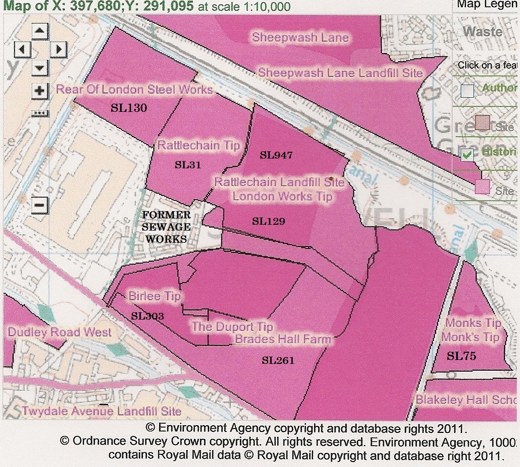
The maps that the EA have provided on their website appear to have replaced some of the old what’s in your backyard feature that they previously removed, and which I also took them to task over in the FOI request I put in some years ago.
The maps can be viewed at the link below. Zoom in and view the pink cross hatched polygons and you will also find some very basic info within these pop ups as to when the site received waste and licence was surrendered etc. This is by no means accurate however, and should be read with caution, as rattlechain lagoon contains no information at all, even though the EA know bloody well what is in there, and if they don’t, well read this website FFS!
It is interesting to note the scale of polygons around the black country area compared to Birmingham and Smethwick and outskirts which escape the depravity of industrial wastes. It is a disproportionate burden around Oldbury and Tipton, where unscrupulous bastards sold off marl holes for this very purpose, only for more unscrupulous bastards to infill them with more solid wastes to build houses upon. The legacy of industry and its political supporters in boroughs like the very ironically named “Sandwell” have left us with nothing but blots on the landscape to replace the dug out pits that went before them.